
Milford ZIP Code Coverage
Milford’s principal standard ZIP code is 01757. The official postal result confirms the Milford station and ZIP, but it does not publish a municipal-boundary polygon. Postal geography can cross town lines, while a town line controls the local clerk, assessor, and election office that hold a record. The ZIP code directory should therefore be read as a delivery and sorting tool first, not as a claim about every address in the town.
| ZIP | Postal coverage | Post office | Research note |
|---|---|---|---|
| 01757 | Principal ZIP serving Milford | Milford Post Office | Postal geography can extend into parts of neighboring communities; verify each full address. |
No separate PO-box-only or unique-institution ZIP serving a Milford street address was located in the official sources. Border addresses can also carry a postal city that differs from their legal municipality. When a records request depends on the town, use the situs address, parcel, or deed rather than the postal city alone.
Milford ZIP Code at USPS
USPS lists the Milford Post Office at 2 Congress Street, Suite 1, Milford, MA 01757-4163, with a public phone number of 508-473-5839. The official result reports weekday retail hours of 8:00 a.m. to 5:00 p.m. and Saturday hours of 9:00 a.m. to 1:00 p.m. Postal hours and services can change, so check the current USPS listing before visiting.
The official Milford Post Office result is the starting point for confirming the station attached to 01757.
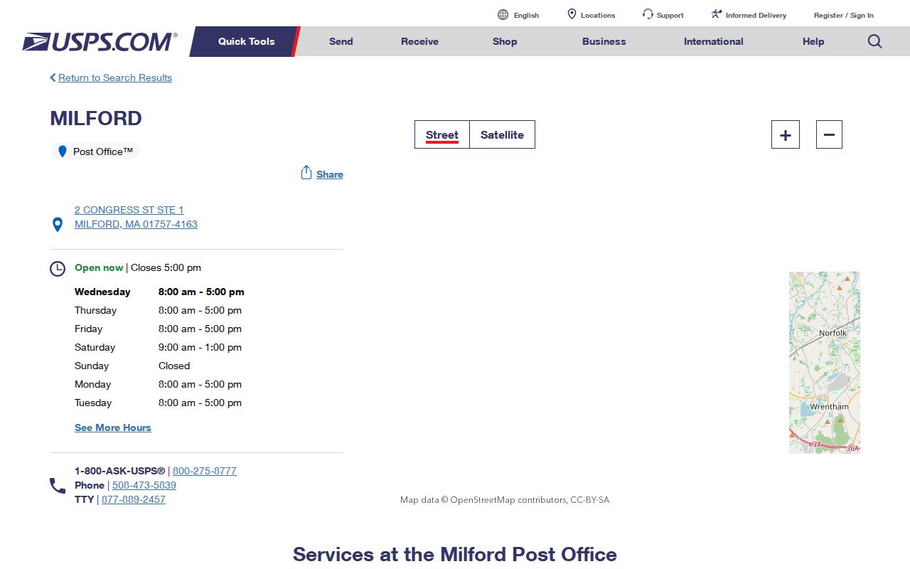
The station result identifies the postal facility, while the address-level USPS lookup is the better check for a specific delivery ZIP and ZIP+4.
Milford ZIP Code Boundary Mismatch
ZIP 01757 is named for Milford, yet postal and municipal geography do not always line up. The research identifies portions of Hopedale and Upton in ZIP reference data associated with 01757. Milford itself sits beside Upton, Hopedale, Mendon, Bellingham, Holliston, and Hopkinton. A ZIP result can therefore point toward the right area without determining which town office keeps the requested record.
Hopedale separated from Milford in 1886. That change matters in a historical directory or deed description, because an older item labeled Milford may describe an area later treated as Hopedale. The former Braggville area is another caution: local history places it in Milford, while modern postal references associate the locality across Holliston, Medway, and Milford ZIPs. Note: Pair a ZIP with the legal municipality before sending a local records request.
USPS is the right source for delivery validation, preferred city wording, and ZIP+4. It is not the source for a deed boundary, a town-assessment map, or a voter precinct. If a full address appears to be in a different town than its postal name suggests, check the parcel in Milford MapGeo, then compare the recorded legal description at the Worcester Registry. This avoids sending a request to the wrong clerk or interpreting a postal shorthand as a change in town jurisdiction.
Milford ZIP Code Address Types
Three address fields can describe the same parcel. The situs address is the physical property location used by the assessor. The owner mailing address is where the tax notice is sent and may be elsewhere. A USPS-normalized mailing address is the delivery form used to verify a ZIP and ZIP+4. Do not swap one for another. A different owner mailing address is not proof that a property is vacant or occupied by someone else.
- ZIP versus ZIP+4
- The five-digit ZIP sorts a broad delivery area; ZIP+4 adds a smaller delivery segment for a full address.
- PO-box ZIP
- A ZIP used for post-office boxes rather than ordinary street delivery.
- Unique ZIP
- A ZIP assigned to one organization or large receiver, when USPS has issued one.
- Carrier route
- The delivery route within a ZIP area, not a municipal boundary.
For an old Milford street name, the parcel ID and the deed’s legal description are stronger bridges than a current postal form. Main Street was once Sherborn Road, Purchase Street came from the North Purchase route, and Highland Street was formerly called Magomiscock in local history. Search those variants in deeds, maps, newspapers, and directories when an address produces no match.
Find Milford Residents by ZIP
No confirmed ZIP-wide filter was found in Milford Patriot or MapGeo. The Town confirms that Patriot supports owner and address searching, but its ZIP filter was not verified. MassGIS standardized parcel data includes CITY, ZIP, OWNER1, OWN_ADDR, OWN_CITY, OWN_STATE, OWN_ZIP, last-sale book and page, and zoning. Those are different fields. A search using the owner’s mailing ZIP is not the same as one using the parcel’s situs ZIP.
- Verify the full delivery address and ZIP+4 through USPS when mail geography matters.
- Use the situs address in Milford Patriot or the town parcel viewer to identify the parcel and current assessed owner.
- Use MassGIS parcel attributes cautiously, keeping situs ZIP separate from owner mailing ZIP.
- When a street is identified, use the Milford by-street directory for address-keyed records and the Worcester deed trail.
The Massachusetts voter-status form also requires the person’s five-digit residential ZIP along with name and date of birth. It is an individual self-status tool, not a ZIP-wide resident search. A municipal voter-file request can be defined by street, precinct, or date, but the research does not state a Milford ZIP-filter option.
The Massachusetts voter-status form shows the required residential ZIP field alongside the individual name and date-of-birth fields.
The form supports a person checking their own registration status. It does not turn a Milford ZIP code into a public resident-browse tool.
When no online filter matches the question, use the documented fallback channels. Milford Assessors can help with a current parcel issue by counter or phone. A defined local voter request goes to the Town Clerk. Planning, building, zoning, or code files can be requested from the relevant town department with the situs address, parcel ID, and date range. Massachusetts Public Records Law, M.G.L. c.66 §10, supports a request for an existing record, not a demand that the office create a ZIP-wide resident report.
Milford ZIP Code Parcel Fields
The statewide parcel map is a useful fallback when a local tool is unavailable. Its attribute design distinguishes the CITY and ZIP tied to a parcel from OWN_CITY, OWN_STATE, and OWN_ZIP for the owner’s mailing information. The map table can be filtered by current map extent, and the service schema makes ZIP available as a field. Use that distinction to narrow a location, not to identify a household.
The Massachusetts Interactive Property Map shows the parcel popup, table, and map tools that support a careful ZIP code comparison.
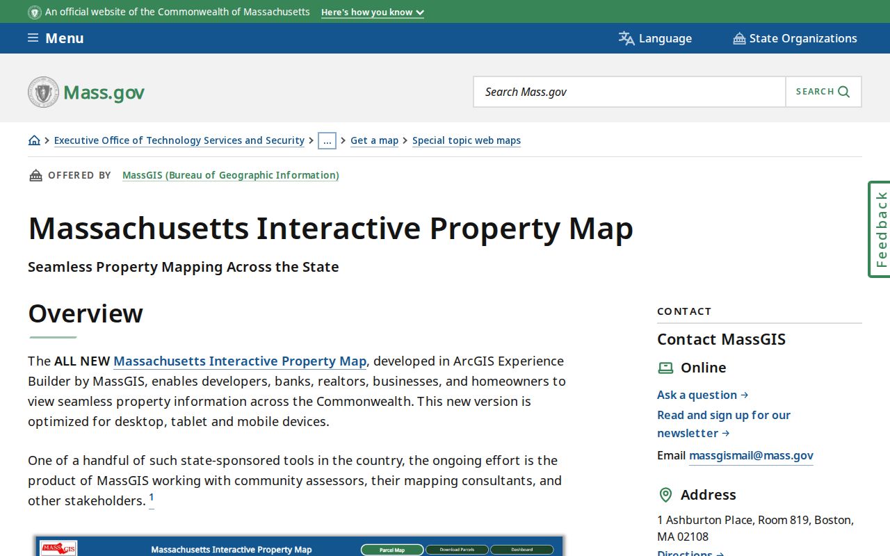
The statewide view is useful for comparing parcel geography, but its ZIP and owner fields must be read as separate data points rather than a roster of Milford residents.
| Field family | Meaning in a ZIP search |
|---|---|
| CITY and ZIP | Standardized parcel location fields, subject to map-data limits. |
| OWNER1 and OWN_ADDR | Owner name and mailing address, not a residence finding. |
| OWN_CITY, OWN_STATE, OWN_ZIP | Owner mailing geography, separate from the parcel’s site. |
| Last-sale book/page | A bridge to the Worcester Registry’s recorded title record. |
MassGIS warns that parcel boundaries are representations, not authoritative legal surveys. A deed and recorded plan at the Worcester Registry control a boundary question. For a simple postal check, USPS is the right channel. For title, use the Registry. For current assessment data, use the local Assessor.
The distinction becomes especially useful when an owner’s tax contact has a different ZIP than the Milford parcel. The field card may still identify the property’s situs and parcel number, while the mailing fields merely identify where a bill is sent. The Registry’s Property, Name, Book, Document, and date tools provide the next title check. Recorded Land, Registered Land, plans, and pre-1960 grantor or grantee indexes are separate paths, so a single search form does not cover every historic parcel record.
Milford ZIP Code History Clues
Postal labels are recent compared with much of Milford’s address history. The Worcester Registry traces its record-keeping to 1731. Milford incorporated in 1780, then gained portions of Holliston and Hopkinton in 1835, and saw Hopedale separate in 1886. Boundary adjustments also occurred in 1907 and 1962. A legal description, plan reference, or parcel identifier can connect those changing descriptions better than a current ZIP.
House-guide directories from selected years between 1942 and 1967 and the Milford, MA & vicinity Blue Book inventory for 1984-1996 offer address-first historical clues. Sanborn maps from 1885 through 1958 show building and street context but do not list every household. The Historical Commission’s Homes and Maps and Streets & Sections PDFs can help bridge an old street name or neighborhood term.
Milford Town Library’s Paul E. Curran Historical Collection adds maps, town reports, resident lists, cemetery records, yearbooks, and newspaper microfilm. The Milford Journal runs from 1852 to 1918 in the library’s listed coverage, the Gazette from 1882 to 1903, and the Milford Daily News from 1887 forward, with possible gaps. A newspaper notice or directory entry can point to the right date or street variant, but it should be checked against the clerk, Registry, or archival source that holds the underlying record.
Milford ZIP Code Limits
A ZIP code directory does not reveal everyone at an address. Parcel records identify assessed owners, and a tax mailing address can belong to a trust, business, or other contact. Public voter records have protected categories, and the state self-status tool is not a ZIP browse feature. Renters, household members not otherwise recorded, protected voters, utility customers, delivery data, and DMV addresses are not a ZIP list.
Practical boundary. Use ZIP information for mail and geographic sorting, then confirm the relevant fact with Milford, Worcester County, or the state custodian that keeps the record.
When a ZIP search reaches a border, write down the full address, current town, historic street variant, and parcel ID. That short set of facts gives the Town Clerk, Assessor, Registry, library, or archive a precise starting point without treating a postal label as a complete directory.